On our way! So we are now boating on the Viking Rurik upstream on the Moscow canal, expecting in a few days to arrive in St. Petersburg. This posting is to share with you the places along the way. Some of the places were scheduled for a stop and we toured them, usually with a guide, and others we just moseyed on by. As a reminder of the journey upstream, I show again the travel map. For example, the first stop I show is Uglich and the second is Yaroslavl.

As we motored up the Moscovi River (and then 79 miles via the Moscow Canal to the Volga River), we passed through several man-made reservoirs and locks. The flooding caused by the reservoirs, built to provide water to Moscow as well as hydroelectric power to it and towns along the way, put parts or all of many towns and structures partly or completely under water. One of the towns along the way was the village of Kalyazin. Here the bell tower of the monastery, which was built in 1694, is still standing, but looking like the leaning tower of Pisa rising out in the water. The monastery was removed before the flooding, but the tower was shored up and left. In the background you can see the surviving village. Apparently they hold a service at the tower once a year (note the dock).
Once we passed the tower and looked back, it now appeared nearly vertical!
When we got into the canal locks, the experience was typical of locks everywhere. Once through this final lock, we encountered the Volga River.
And leaving in lower water - under sister Connie's supervision.

We passed under various bridges along this part of the system (below). An interesting story from our last Viking cruise along the Rhine involved bridges. On the Rhine, the bridges were so low that the ship had its captain's control cabin on the top of the ship manufactured to drop or sink down into the floor at bridges and have its roof become flush with the top floor of the ship. When accomplished, the ship could pass under all bridges without being 'shaved' off by a low slung bridge. When we got home from that trip, the news reported that one of the Viking ships on the Rhine had its captain's cabin shave off by a bridge and the crew therein died! Somebody was clearly asleep on the job that night!

We soon approached the village Uglich (on a reservoir of that name), which was founded in 1147. Again the theme of churches was obvious. The view of the Uglich was heralded first by the island offshore of the village. It too was called the kremlin (meaning citadel, or seat of government) and has an exuberant history related to Ivan the Terrible. This area was a favorite of the Czars as it was reasonably close to Moscow, and the locals loved the churches, which you can see as we approached.
As we pulled up to the dock, some of the buildings appeared to be quite close.
As this was a stopping place, our ship, the Viking Rurik, docked at the pier and we went ashore.
We took a look at a map of the kremlin area, where the royal family lived and worshiped. The buildings on the mainland are where the local people live.
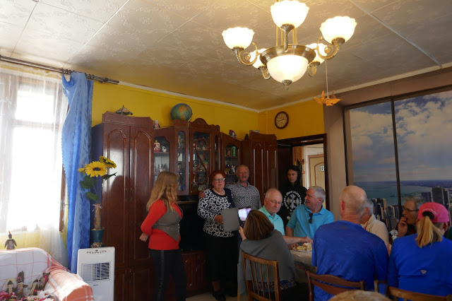
Immediately after arriving, we were divided into smaller groups and each group was taken to the home of a native Uglich family to experience local domestic life. This involved cookies and cake and vodka, and a self tour of their gardens. Apparently all the local people grow extensive gardens for fresh vegetables, fruits and flowers. But first there was the vodka, which Nancy skipped, but not me. The family is at the left end of the table in the picture (mother, father and son) and the interpreter is to their right in red. Some of the family, however, knew a bit of English.
Out in the gardens there were still a few growing plants as this was late September. Some flowers.
And a few berries. There had been much harvested previously by the looks of their compost piles.
When we returned from the family gathering, and recovered from the vodka, we walked across the wee bridge to the island. Here we were greeted by two elder stateswomen in traditional dress performing a folk singing routine to introduce you to the royal housing and cathedrals.

What used to be the residence of the banished final wife of Czar Nicolas and her children in the kremlin was quite modest compared to the several cathedrals right by it.

On another side of this building was a statue of a young prince, Dmitry. There is a story here. Ivan the Terrible was the ruler of Russia in the mid-1500's. He did great things for Russia, bringing the country from a peaceful state into an Empire. He instituted much in the way of peaceful reforms and modernization, such as revising the legal system and introducing self-government to rural regions. After his first wife died from poisoning (but not by him!) his personality changed. For a time he abandoned his role as Tzar, or ruler of the all Russia and the Boyer Court (boyers being the rich landowners and other privileged citizens), but it was soon discovered that without him the country was failing. Thus he was needed and agreed to return, but only with absolute power. This resulted in a terrible time for the peasants as their taxes increased 10-fold and many killings were undertaken, such as in 1570 against Novgorod, in which 2,000-3,000 people were murdered, including many of the rich. When Ivan died, his eldest son was too frail to take over, so a 'regency council' took over managing Russia under the control of Boris Godunov in 1586. Godunov, who was of Tartar origins, was the dude that banished Ivan's wife and children to Ulgich along with Ivan's only remaining son Dmitry. And then, to no one's surprise, Dmitry was murdered there as an 8 year old. The statue below was of him, and the area is call the blood, so they built a church there called St. Dmitry on the Blood. Godunov then became the only non-royal czar of Russia. Dimitry's statue is outside the house where they lived and he died.

The Church of St. Dmitry on the Blood is just next door to where his body was discovered. Inside, the church is replete with vivid frescoes memorializing the death of Dimitry.
The second cathedral on the island was the Church of Our Savior's Transfiguration. We didn't go into this one, which is reputed to be quite decorative with icons.
And looking back from the island to the town on the mainland we could see the beautiful domes of the Epiphany Cathedral, attached to the Epiphany Monastery.

After attending a performance of a local men's folk singing group, it was time to return to our boat. As you can see, several other boats had arrived by this time, and they stack up side by side. If you are in the second or third vessel, they are arranged so that you walk through one from inside into the next one until you arrive at your boat! It is well thought out and efficient.
Up the Volga we went to our next destination, Yaroslavl, where we arrived the following morning.
Yaroslavl became a large Scandinavian-Slavic settlement after Prince Yaroslavl (one of the original princes asked to rule over the Russ' in the 10th century) stepped ashore on what is now Strelka Park. The town currently houses about 600,000 souls. The prince ruled the area from 988-1010. In the 17th century it was Russia's second largest city, and for a time during the brief Polish occupation of Russia in the early 1600's, it was the de facto capital. After offloading in Yaroslavl, our foot tour began. First we saw the 17th century Church of the Nativity. This was the first church to be decorated with glazed tiles, a style soon to be adopted across Russia. There are many preserved churches in Yaraslavl representing various architectural Russian styles over the many centuries.

We paraded along the Volzhskaya Embankment to our next viewings. This is a mostly wealthy town harboring several nice buildings... the names of which I don't remember. There are two monasteries in the town, which were both profited from rich gifts from the court of the Tsar.
Next we saw St. Ilyas the Prophet Church. This church was originally built the 1831, but it was claimed by fire in 1931 and rebuilt again in 1950. Since most of the original churches were built of wood, so many of the churches in Russia have been reconstructed many times over the centuries, usually in a manner that replicated the original style.
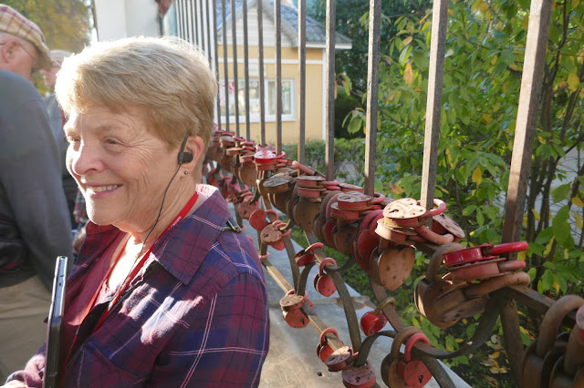
Further down the Embankment was a fence around a gazebo that overlooked Strelka Park, where couples are married and then often secure a lock as a symbol of their fidelity -- with a certain amount of luck! The guide said that only about half of these marriages survive.
Not surprising that 'well adjusted' Nancy settled in there for a time!
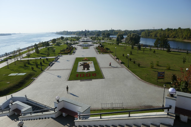
Strelka Park is the peninsula area where Yaroslavl first landed, and is now a very attractive area below the city which lies between the Volga on the left and the Kotorosl River on the right where it flows into the Volga. We didn't climb down and up the many, many steps of the embankment down to the park.
Under higher power we can see the fountains in the distance near the end of the park.
You can see here the bear emblem in the closest viewing. The date in the display celebrates the town's founding, and the bear signifies the beast that the local inhabitants set onto Yaroslavl when he first explored the area in 1010. He is reported to have easily dispatched the bear and thus won the locals admiration, hence the bear became the city's emblem.
We walked on to visit several buildings in the City Centre, including the Russian State Academic Drama Theatre (the Volkov Theatre), which is the first professional theatre in Russia (established in 1750),
and the Soviet Oblast building (the Capitol building) on the city square which we were not allowed to approach. An oblast is a geographic administrative district similar to a state or province in our culture.
It was topped, as one might expect, with symbols of Russia.
Right across from the Government Building is the Church of Ilya (Elijah) the prophet. It was build in the mid-17the century, paid for by local Yaroslovl merchants.
Frescoes cover every possible surface in this church, telling well-known stories from the Bible.
And finally the riches and icons are displayed. I love the modern purple lamp stick out from the rich decorations. There are very specific rules for icon placement at the front of an Eastern Orthodox church. Generally there are five tiers, but there is not always room for all five. The bottom tier is found in all iconostases and is called the "Sovereign Tier". It depicts the birth of Christ and his second coming. It usually includes local saints and feast days. The next tier up is the "Prophet's Row", and has images of the major prophets from the Bible. The third tier is the "Festival Row", which depicts the 12 Feast Days of the Christian calendar. The tier above that tier is reserved for Old Testament prophets, and the top row contains icons of the twelve apostles.

Leaving St. Elijah's, we walked along a beautiful pedestrian boulevard that included interesting sculptures and memorials toward the Assumption Cathedral. In front of the Cathedral is a war memorial with an eternal flame. The entire memorial includes a sculpture representing the soldiers on the front who fought for Russia (which you can see here), as well as another sculpture on the right (not seen here) that represents the women who stayed home to support families, the heroes of labor (no pun intended).

Next to the Cathedral are the restored external set of carillon bells from when the Assumption Cathedral was destroyed.
The Assumption Cathedral is stunning outside and inside (although we did not enter it). It was blown up by Bolsheveks in 1937. Its more modern replica was completed in 2010.
Here is the same cathedral from the front, but now in shade at this time of the day.
There is a beautiful painted mosaic above the entrance.
Leaving Yaraslavl in the late afternoon, now heading upstream, we headed north and west along the Volga in the late day sun.
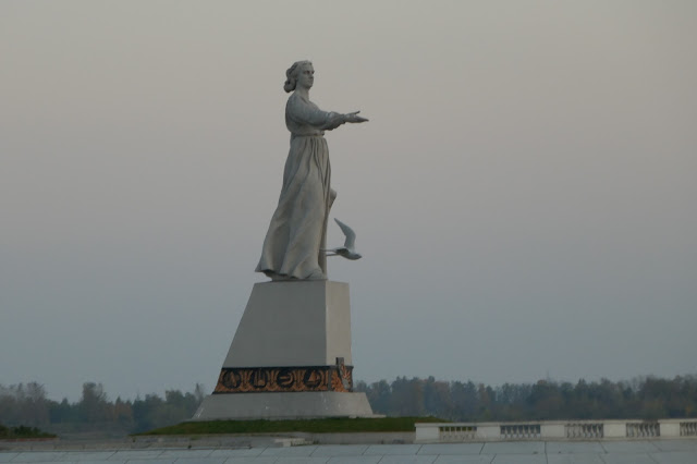
Soon we reach the Rybinsk Reservoir, where we encounter Mother Volga with her outstretched hand welcoming those coming from the north. This is Russia's "Statue of Liberty".

As we pass her by, she is greeting those heading to Moscow at the Rybinsk Dam. It is said that the scroll in her left hand (unseen) holds the plans for the dam.
The next day we arrive (in the fog) at the small river port town of Kirillov on the shores of Lake Siverskoye . Here we left the boat and were bussed to visit the various structures, where we toured through the Kirillo-Belozersky Monestary. They are now in disrepair and under reconstruction. It is surrounded by an impressive wall.
As we approached the main entrance, we could not help but notice the huge the wall. Begun by a disciple of St. Sergius of Holy Trinity Larva, this monastery began as a single cave dug by two men, and grew to be the largest monastery in all of northern Russia. It is now a World Heritage Site.
The walls of the entrance were covered in very old murals, all in desperate need of redoing, which appears to be scheduled for a future time.

The internal structure of the monastery was huge. Nearly all of the rooms that once housed monks were empty and in near total wreckage, but the walls were still intact. It appeared more like a tired old prison (which it was used for during Catherine the Great's time) than a place to live. However, it must have been some sight in its day.
It eventually became two monasteries that together had 11 churches within the walls. In the 15th to 17th centuries, it became a place of pilgrimage for the tsars. Ivan the Terrible visited frequently and left large donations. Some of the buildings appeared to be in good repair, but most of those buildings were not available to us.
One of the buildings was a museum, which we could enter, but no pictures were to be taken. We toured through a room with many of the impressive large original frescos gathered from their banishment from the monastery during the years the Bolsheviks ruled. Some were actually located in the Gate Church at Trinity Lavra. Each is now protected in this museum within its own glass case.
We walked through the lake-side entrance to the outside to view the original Lake entrance. At one time there were docks outside the walls. The water is quite clear, as no motor boats are allowed on this lake.
Back in our bus we were driven to a local school, where we were entertained in a small auditorium with a dance performed by several young ladies in tradition garb. Except for the Russian language throughout the school, one would not know we were in Russia.
We then gathered in one of the classrooms for a question and answer session with a student about the history of the town. It was indicated to us that this was an opportunity for the student to practice her English! This area is dependent on tourism, so many of the children in this school learn a second (and maybe third) language, such as German, French, or English. When they graduate from their last school level (grade 11), many want to undergo the intensive education of qualifying to be a tour guide as a career. She did a good job, only having to request help from the local tour guide a few times for terminology.

I was looking forward to some local vodka, but there wasn't any available. So it was back to the boat and now time to motor overnight along the Volga and on to Lake Onega's north end, where the rural reconstructed village of Kizhi Island is located, as was indicated previously on the map. The next two stops were both reconstructions (in progress) of villages as they existed before being destroyed by fire and/or the Germans in previous wars (both Kizhi and Mandrogy), but with very different approaches to rebuilding.
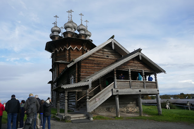
Kizhi Island is a World Heritage Site, representing the highly developed carpentry skills of the Russian people. The buildings on Kizhi, which largely consist of buildings transferred to this island from other areas of rural Russia, represent medieval and post-medieval Orthodox settlements. Two 'original' churches were built by missionaries, but other buildings have been moved there from nearby locations. The tour was led by and information given by tour guides and local people who work there. This site reminded us of Upper Canada Village along the St. Lawrence River.
The first building we walked past was the 22-domed Transfiguration Church. The original church on this site, built by missionaries in the 1500's, was hit by lightning in the early 18th century and rebuilt in 1714. The church is all wooden and was built (and is being renovated) in the traditional Russian style with wooden pins rather than nails. However, nails are used to secure the domes and roof shingles.
And a closer view.
And the domes.
The guide showed us a picture of what this church looked like before it was raised, and it is to look like that again when they are finished the reconstruction.
Nearby was a second church on the island, the Intersession Church. This church was used normally by the island's inhabitants during the winter (but is now used full time while the larger one is under construction).
Its interior was simple as were its many icons.
They even had some lovely paintings that had been brought here from elsewhere.
Between the two churches was the island's graveyard. Off to the side and in the back you can see the typical Russian Orthodox cross, which has three cross-bars on it. The top represents the Pontius Pilot's inscription on the origin cross of Jesus (King of the Jews), the second, the bar which held Jesus' arms, and the third stands for the two thieves who were crucified on either side of him - one went to heaven and one to hell. This bar represents the balance of Justice.
The domes of both churches were perfectly constructed by hand from aspen boards.
We had a opportunity to watch craftsman on the island creating the individual shingles that make up the dome roof. Each one was nearly identical to the last one. All done by hand with an axe.

Also in the enclosure was a church steeple (separate structure), built in the same style.
We then toured through a reconstructed farm house/workshop, which, given its size and the number of rooms, must have belonged to a well-to-do family. One interesting feature was the large plastered stove in the living area, which heated the entire building. We were told that the covering over the stove was a coveted place to sleep in the winter.
On the top floor and in the back of this unit was a large workshop area, below which the farm animals were overwintered to protect them from the cold, and also to help heat the building.
The room was used for building and repairing equipment, as well as to store outside materials not in use during the winter.
This area was accessed either through the living area, or from the outside so that the heavy equipment could be brought in more easily by sliding it up a ramp made of logs. Since there were very few trees (left?) on the island bigger than 8 cm in diameter, you would wonder where the logs (and firewood) would have come from (maybe all cut down to build the structures?)
The farmhouse was decorated with a variety of folk art and pre-Christian talisman symbols that were still used in the 16th and 17th centuries to protect the house from evil spirits.
In addition, there was an example of a windmill used at the time for energy.
In the field next door was a unique form of fencing I have never seen any where before. Simple but highly effective constraining the cattle!
Throughout the area, we were engaged often by 'wild' mallard ducks. It was fun to see a native of north America in the northern reaches of Russia.
After walking around the entire island of Kizhi, we returned to the boat. Apparently they put the name of where we were staying under our stateroom so we could find our way back to the correct location. 😊
Now to the dining room for a glass of wine and dinner as we begin once again to 'sail' further toward St. Petersburg.
The meals were a highlight of my day, as we got to hang out with our uninhibited waiters, who made the trip very enjoyable. And the food was great!
We then returned to the Baltic waterway from our excursion to the north end of Lake Onega for our final leg of the journey. We enter the Svir River and motored to the village of Mandrogy. See the map below as a reminder.

As you can from the map, Mandrogi is on the Svir River half way between St Petersburg and the island of Kuzino. It was an important trading center before Peter the Great ruled. Much mining was done here and ship building. It was also an important fishing town and wonderfully isolated. Then came the Napoleonic wars, and it was burned to the ground, which was followed by being totally demolished by the Germans in WWII, forcing all citizens to vacate that area. With the fall of the Soviet Union, Russian investors bought the land and invited the best of the region's woodworkers and craftsmen to use their creativity and traditional skills to restore the town to its former glory. Nearly a half century later, between 1996 and 1999, it has been reconstructed in a dreamy idealized fairytale form by an arts benefactor with he traditional buildings restored. Today it is called Upper Mandrogi. On Mandrogi, there is also a helipad for Putin (who has a
residence there) and vacation homes
for rich Russians, as well as guest cottages. Here is what the island looks in schematic form.
As you can see, this is quite an elaborate community and it is often referred to as Russia's Disneyland. As we explored the island, there were many quaint houses and cottages to be seen.
Some of the buildings were houses and cottages, and some workshops and 'boutiques'.
And there were birds to see - apparently many woodpeckers, which I did not see, but a few magpies.
Mind you it was not a real nice day for hanging out in the woods. We were only marginally prepared.
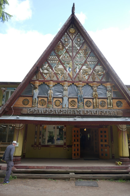
The following building housed a series of shops for artists and craftspeople, selling things from semi-precious jewelry to hand-painted silk scarves, to nestled dolls (matryoshka dolls). Nancy got a lot of Christmas gift purchases here!
In fact, among other things, the island has a matryoshka-painting workshop.
More shops...
And then there was the world's largest feltboot (how Disney-like can you get?)
Not all the buildings were new. Some were quite old and still occupied as shops.
We
also saw a few flowers (my favorite part of the island), including dahlias.
And more...
Following this adventure, we returned to the boat to continue our trip to St. Petersburg by crossing the largest lake in Europe, Lake Lagota. Much to our surprise, as we were eating dinner and night fell, the captain said he could not continue as the waves were now 7 feet in height, so we anchored into the storm and hoped for the best. Not too comfortable in a flat-bottomed river boat, I must say.
I have a movie of this action that I did not include. Yikes. Still dinner felt quite safe at least for now.
Indeed, we were able to begin moving again before dawn and arrive the next day in St. Petersburg!!! On to the third and final segment of this trip; this next part will exposed you to our memories of the city of Peter the Great. It is quite a scenic place. Until then ...


