

When we arrived at our first destination, Seattle, we discovered that Nancy had picked up the wrong suitcase in the Seattle airport. This was not the best start at 10 pm. Happily her case was still there at the baggage the next day, so we were good for phase two, three days later, which was the trip to the 50th state. The direct flight to Kona on the west side of Hawaii was nearly full and the Big Island had no Covid-19 cases at that time and only one while we were there. Thus we felt quite safe.
Since this post is a log of our adventures on our brief visit to Hawaii, I enclose a map of the island so that you could follow our journey if so desired. The roads around the island are in red, but you likely cannot read the numbers. The brown areas are various lava flows from the different volcanoes, mostly heading to the ocean. We stayed on the west side of Hawaii, as the weather there is reported to be more to our liking (i.e., the average rainfall in the west is less than 30 inches per year, while in the east it is closer to 300 inches!!!) Much of the weather comes in from the east and loses its water approaching the three major volcanoes, Mauna Kea in the north central, Mauna Loa in the south central and the most recently active, Kilauea crater in the southeast, which is still growing, and last erupted in 2018. The first two are nearly 14,000 feet in height. The Saddle Road runs east and west between the two. There is another volcano - Kahala - in the far north which originally began forming this island; it has been dormant for over 120,000 years. We have circled the four volcanoes on the map below.

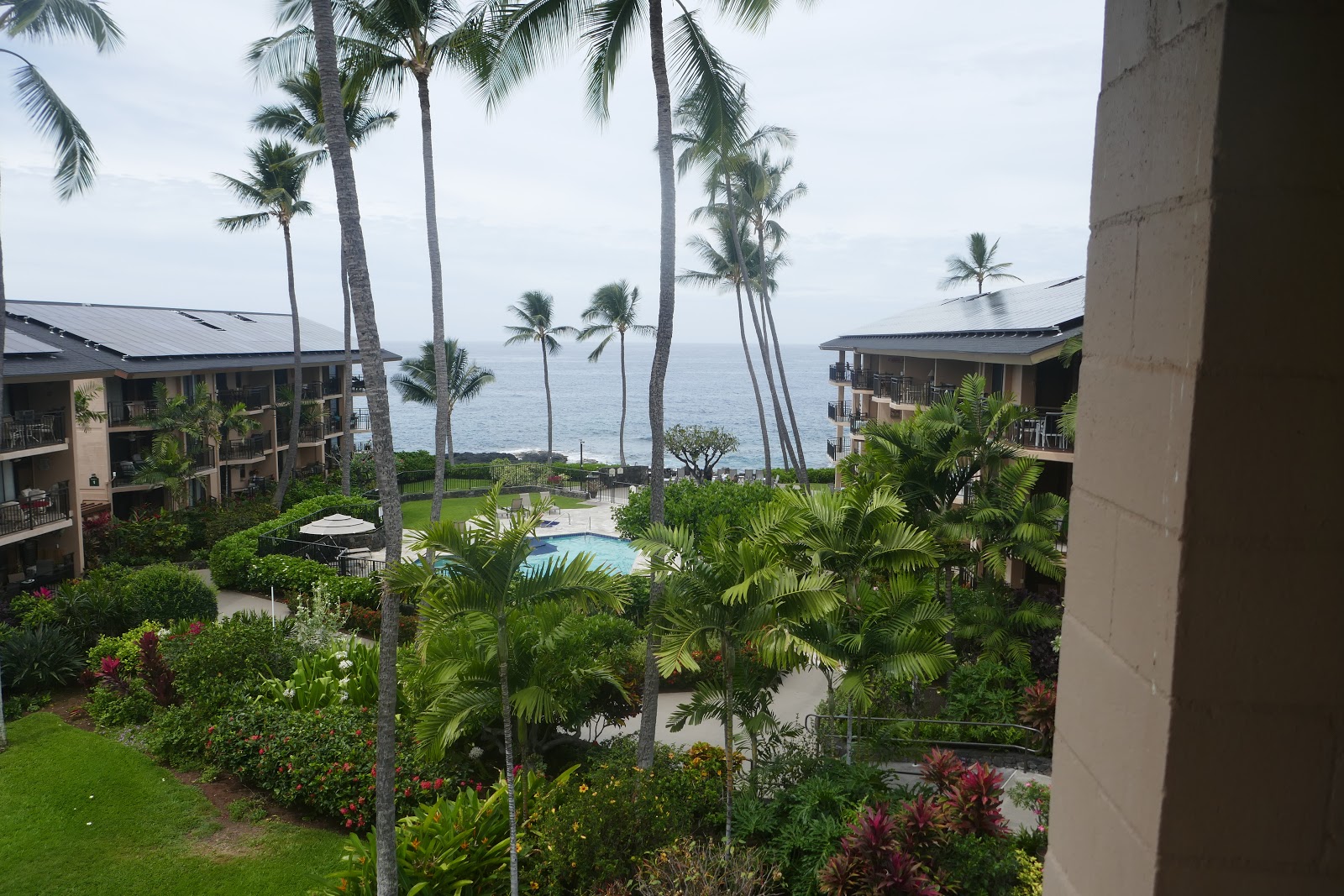
Our condo for the week in Kailua-Kona was quite spacious and very comfortable with a balcony (lanai) on all three sides and a decent view of the ocean.

For example:
Being there with daughter Jenifer and husband Scott was a great treat.

The basic island is all lava, which is used as 'rocks' for building everywhere you go. The landscaping around our condo was nearly all natural lava stone, with some added soil for growing flowers.


In the same vein, a picture of me to show I was there too. 😀 Usually the camera man is never seen.

On the second day, the kids took us to snorkel at a beach in south Kona, just a few miles away from our condo. These beaches were not white sand but crushed black lava over centuries. This snorkeling beach, Kahalu’u Beach, was a favorite of Jen and Scott's friends, Liko and Simon, who were visiting the island at the same time as we were. The beach was also used by swimmers and surfers.

The four serious young snorkelers talked me into entering the water by sliding over the 'rocks', which I successfully accomplished with some difficulty, but no injuries.

But soon I disappeared and Nancy came looking for me, as though I had been taken by a local black fin shark.

There was much to see in the shallow waters off that beach. Especially the numerous orange spine unicorn fish and yellow tang.

Left to right below is the surgeon fish, yellow tang and the convict tang.

This experience also revealed an unusual sea urchin that was new to me called the red pencil urchin from the Indo-pacific region. Its Hawaiian name is ha'uka'uka'ula'ula. Can you just imagine saying it? I am sticking with the red pencil urchin.

It often appeared in clusters.

Or next to anemones and coral.

Jenifer's favorite was the guineafowl puffer - known as o'opu hue in Hawaiian.

But I liked all the underwater creatures...

including a common green turtle...

...who chose to surface for air near Jenifer, who had my underwater camera. All very inspiring!

After snorkeling, we all rested. Here Simon hid from the sun on the tiny piece of beach sand they had corralled, which was well away from the nearest swimmers and surfers. You can see on the left that the 'beach' walk to this location was all rock and lava.

This area was typical by having many tidal pools with a plethora of interesting creatures. Note the man-made lava rock break-water in the distance, designed to protect the beach from heavy surf.

In the pools I found many interesting fish and others creatures. Here were 3 young bone fish in the pool where Nancy was standing in the above picture.

Simon also captured some sea turtles in the following two picture. The first picture is a single turtle.

And the second picture captured 4 turtles, with a snorkeler in both pictures.

The following day, our next adventure was to drive to the northwest end of the island near the village of Waimea, where the road ended at the Pololu valley, shown on the map. This valley was one of the seven valleys of the Kohala volcano, the first and oldest of the Big Island volcanoes. Rather than just looking down from the high cliff to the beach below, we walked down an old road to the bottom. The following picture was taken half-way down to the bottom.

As to this old "road"... what a joke! Admittedly it began as an old road.

But soon changed. Can you imagine that this was a road!! Jenifer was watching out for me so that I didn't do a face plant on the way down. The walking poles were critical for my survival.

We rested half way down, while Nancy scared me by standing close to the edge of the cliff on one of the road's hairpin turns. Note the quality of the road here!

When we got to the bottom, there was a beach with black sand and boulders surrounding it, and a creek coming into the beach from the cliff on the east side.

But it was pleasant and relaxing. Note the girl in the background is 'surfing' in an area that the signs indicate is a bad plan -- big undertow and sharks. Natural selection at work.

But she survived several iterations.

And so did we on our final ascent up that lovely road. Me, just barely.

Safe at last!

Looking back down to the ocean, the cliff structure on this end of the island is quite spectacular with no other access.

From there we started back south to Kona on the west side of the island from this most northern peninsula exposure. We stopped at Mahukona Park on the northwest side of the peninsula, which was sort-of open, to eat our various varieties of delicious sushi that we purchased from a sushi shop in the village of Hawi. I couldn't resist the yellow fin tuna for most of my meals in its many forms. This park had an interesting view of Maui, which was only 30 miles north of Hawaii -- just noticeable above the clouds. Maui is older than Hawaii, which is the youngest island in this volcanic chain. Maui is not as close at it looks in the picture, as I have taken it on half zoom. Thus it looks like its 15 miles away 😎 in the picture. You are actually looking at Maui's Haleakala, or the East Maui Volcano, which is a massive shield volcano that forms more than 75% of Maui. The western 25% of the island is formed by another dormant volcano, Mauna Kahalawai, also referred to as the West Maui Mountains. This is the volcano on Maui closest to the Big Island.

The country between the rainy northern peninsula to the dry Kona was not the lush jungle that you might have expected in Hawaii, but grassland and cattle. Where we were in Waimea, many ranches exist. The biggest one on the island is the Parker ranch, which owns and runs cattle on 130,000 acres!!

The landscape was also punctuated by lava flows from previous eruptions, which you can see as brown areas on the map running into the western ocean. The recent lava beds were now being colonized by a hardy grass evident along the road next to the flow.

... as well as on the lava beds themselves. Note the green grass area between the near and far lava fields.

This wild grass was quite pretty. The lava apparently is quite porous, which allows it to retain much of the minimal moisture that falls on this west side of the island.


With a day of additional traveling not required, Nancy and I hung around town and walked while the kids went snorkeling again. At sunset, the kids took a commercial cruise out into the ocean not far off-shore to swim and film the giant manta rays. The swimmers hang off the edge of a raft with big light beams illuminating the water below the raft, which attracts little fish and a variety of edible creatures -- edible according to the manta rays. Below is a movie Simon took showing the feeding pattern of the mantas and how close they come to the viewers, missing Liko by only inches. The guide said that the biggest ray in the group was a female with a 22 foot wing span!!
The next day, because of the coronavirus pandemic, the state parks were all closed even though there were no cases of Covid-19 on the big island yet. As a result, our explorations became considerably more restricted. We drove down to and along the south end of the island to see what we could at the Volcano State Park. This is where the Kilauea Caldera is located and where its many steam vents exit. The caldera began up welling to the surface in 2018 into the nearby community, an upheaval that began in 1983 but has now finally stopped.

Here is a panoramic view of the caldera that gives you a sense of its depth and size.

Since we were now on the south EAST side of the island, the rain has found us.

Here is a typical vent, where the rain goes down to where it is scalding hot, then vaporizes and returns as sulfur smelling steam. It creates all kinds of crystalline structures and colors.

All through this park area were examples of how the land recovers from the lava with tree growth (as well as the grass I showed earlier). The most common tree to colonize the lava in the moist parts of the island is the unimpressive 'bush', the Ohi'a lehua tree. It was the original colonizer on the east side of Hawaii and is actually an evergreen tree! Here is a very young one.

But then they grow taller and have flowers and fruit. Indeed excellent honey can be gathered from them. Here is the beautiful flower.

And the associated fruit.

With time and accruing soil, different varieties of ohi'a can grow to huge heights, over 100 feet, like the one Jenifer is standing under below.

We then drove to
the other side of the caldera, where one could walk on Kīlauea Iki Trailhead, a path inside the
volcano bottom that passes over the volcano bed (we didn’t do that trail). Instead, we walked along a much more user-friendly path on the higher ground, the Devastation Trail, that ran along the side
of an older eruption in 1959. We walked on this asphalt trail between this lava hill of pebbles to the north and older flows that were now covered with vegetation to the south. The 1959 flow was so explosive that it did not
have a chance to destroy some of the tree trunks that still stand in the midst
of it. In the picture below, one dead tree that still stands there and is shown on all the postcards of the explosion debris along Devastation Trail where Scott is standing.

A picture of one of the actual explosions here is shown on the park's description poster.

This explosion was Pahoehoe lava, which is not the smooth lava shown latter on, but stone pebbles, called Pele's Tears. The size of the pebbles can be assessed compared to my shoe.

This explosion covered the road to a height of hundreds of feet with Pele's Tears. In the next picture you can see the new 'end' of the original road at the white sign. The old road is buried under the mountain of volcanic pebbles beyond it.


Some of the new growth on the Pele stone is a pretty little flower that forms berries that the Hawaiian goose, the Nene, likes to eat.
You can see how it is widely but sparsely distributed on the stone field.

Along Devastation Trail in the adjacent older growth are many unique trees, bushes and ferns. Here is the one I liked the best, the Hapu'u fern tree that is about 15 feet tall and can be thousands of years old -- repeatedly collapsing down on itself. In its presence, I kept expecting to see a prehistoric beast approach us. Nancy indicates the fern's size. Note the fern's 'fiddle head' emerging from the plant.

The give away of being a fern are the brown 'fiddle heads', which you can see barely in the above picture, but much better with Jenifer serving as a comparison. Apparently they are edible, but the natives did so historically only as starvation food, as they required lots of preperation before they were edible.

The Hapu'u fern also has lovely leaves, when you can actually see the top of the plant.

By comparison, small domestic ferns have been planted along the roadways to and from this area.

The next day we headed north again but this time turned right onto the Saddle Road, which runs east and west the width of the Island between the two biggest volcanoes, Mauna Loa to the south and Mauna Kea to the north (see the earlier map).
Mauna Loa is one of the
two largest volcanoes in the world. Mauna
Loa has erupted 33 times
since its first well-documented historical eruption in 1843. It has produced
large, voluminous flows of basalt magma that have reached the ocean eight times
since 1868. It last erupted in 1984, when a lava flow came within 7 km of Hilo, the largest
population center on the island, at the east end of the Saddle Road. One interesting
structure associated with this activity is the “jello mold” hill. This is an ancient cinder cone structure (seen below) between Mauna
Kea and Mauna Loa. It is known as the
Jello Mold due to its resemblance to an upside-down mold. It is hard to see it from this distance, but there are actual trees on the top of this structure. Cinder cones are the
simplest type of volcano. They are built from particles and blobs of congealed
lava ejected from a single vent. As the gas-charged lava is blown violently
into the air, it breaks into small fragments that solidify and fall to the ground as cinders around the
vent to form a circular or oval cone.


And Mauna Kea to the north with its snowy top.

A few more miles along the Saddle Road, there was a little unattended park where we pulled off to examine its story. Here was an original native trail where the natives crossed the country to trade and engage in war with other tribes, and later was used by ranchers to access the interior lands where ranches were located. It is the only relatively smooth surface in the back areas that were originally covered in lava.

Immediately next to the trail was the surface most common in this area. This adjacent area is covered with a different type of lava, called a'a - that is it in chunks. Can you imagine an army of natives marching barefoot through this chunky material? Apparently if you fall into it, you will be cut up and injured.

Mixed in with the chunky lava is another form of Pahoehoe called rope lava.

And the more obvious and typical smooth form of Pahoehoe lava.

From here we drove on to Hilo, the largest city on the Big Island with a population of ~43,000. Then we turned north and drove along the coast. Here there were many fields of coffee trees (bush like) from which is made the famous Kona coffee. You can see the coffee bushes just beyond the fence. Unfortunately the pictures were taken from the car while driving.

In addition to the coffee tree, there were acres of macadamia nut trees. In fact, we passed one farm that was 2,500 acres of trees. Although originally from Australia, the tree took immediately to the lava fields. Because the lava is porous, water and fertilizer get to the roots quickly and remain available to the trees. After the nuts mature, they fall to the ground and remain there til fully ripe. At that time they are harvested by hand, as machines cannot run on the lava stone without destroying their tires. The nuts also require 300 pounds per square inch to crack, so this is done by a machine, and then they are roasted. Sixty million pounds are produced each year on the Big Island. I do love them. Again a drive-by picture.

When we arrived in Hilo, we found a restaurant serving lunch inside -- wow! We hadn't seen that for days! Then we drove down Banyan Tree Drive in downtown Hilo, where there are dozens of huge banyan trees. Many of them are named after people who planted them, like Babe Ruth, President Franklin Roosevelt, Amelia Erhardt, etc. Take a look at this puppy with me under it.

From here we drove north on a small coastal road over the many streams that flowed to the ocean on this 'wet' east side of the island. We stopped at one of them and took some pictures.

Jenifer explored downstream into an area I couldn't manage, where access was using roots like a ladder.

In this wet area, there were many more trees and vegetation that you might think was typical of a jungle-like environment. And here in the fog there were large native flowering trees!!

Up close the flowers look like this.

And compared to my hand like this.

When we finally got back to the main highway at Waimea, we continued west to the Kohola coast where we'd been earlier in the week and then south to Kona. Again there were many farm acres devoted to 'crops' like the eucalyptus tree. There are many hundred varieties of this tree, including the beautiful rainbow eucalyptus. The farms we passed were not the rainbow variety, but likely E. globus. This type of trees is invasive, brought from Australia to Hawaii around 1890 or so to be used mostly for lumber and fuel. They can achieve great heights apparently around 200-300 feet! This plantation was typical and consisted of small ones. Again a drive-by shot.

From here we zeroed in on a park example of the lava channels that run under ground. The park was closed, but access to the lava channel was open.

This cave channel was 20 or more feet underground with access down a concrete stairway to break in the channel.

Inside the cave, the view of course was dark. To explore it would require a headlamp or a flashlight, which we did not have. Looking back, this is a far into the cave as I went. Note the smooth lava flow here in the channel.

Lava can be different colors. The version here was red and brown. The flow underground apparently can be for miles.

Closer to home, we sought out a black sand beach noted on the maps, but it was closed so we couldn't get near it.

From here to the grocery store and more tuna, then back to the condo for a glass of wine and our last Hawaiian sunset.

...remembering the swaying palms before seeing ice and snow again.

Since our flight back to Seattle was the next night, I had all day to capture the flowers, which I previously thought would be native to Hawaii, but are actually imported. First, a plethora of hibiscus.


And many others in the area, including the desert rose.

And the plumeria tree, which is native to Cuba, but transplanted everywhere here in Kona.

I even found a red/pink one down the road.

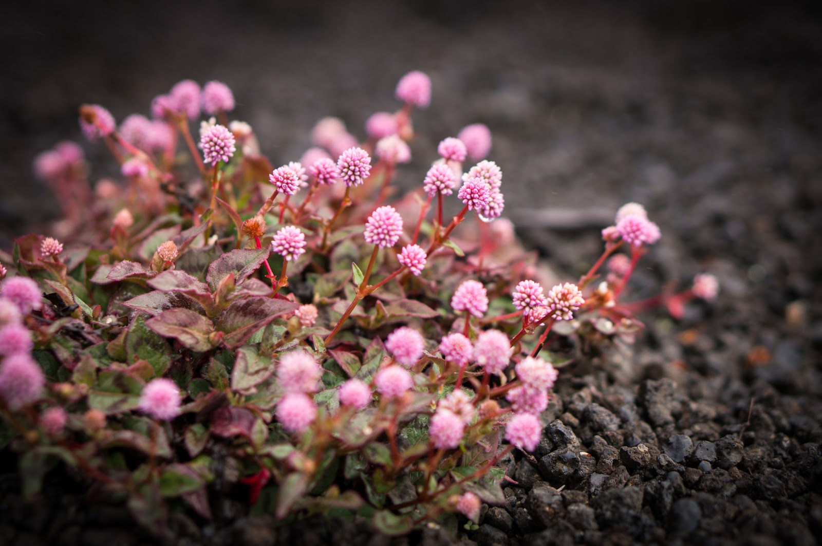
Then there were others that I did not know.


And the omnipresent, bougainvillea.

And many more in my picture file. So off we went to the airport. The open-air airport building has only a few walls and ceilings. This was not so 'cool' when the rain began, but we did find one roofed area near our gate and only had to walk in the rain to the airplane.

Once on board, we scrubbed the area for viruses and 6 hours later were in Seattle.

A few days later we were able to get to Vancouver and then another overnight flight to Toronto and finally to Ottawa. We were isolated for the next two weeks, but Jamie and family would come over and spend some quality time with us. 😃

As our quarantine is now over, and we are now just 'separated at home', we will see what the future brings. Best to you all, and hopefully you will all stay healthy too.